
|
Getting your Trinity Audio player ready...
|
Most clients want to see some of your work before hiring you to shoot something.
They are looking for work similar to what they are hiring you to shoot for them.
I am starting from scratch by offering Aerial Photography using my Drone.
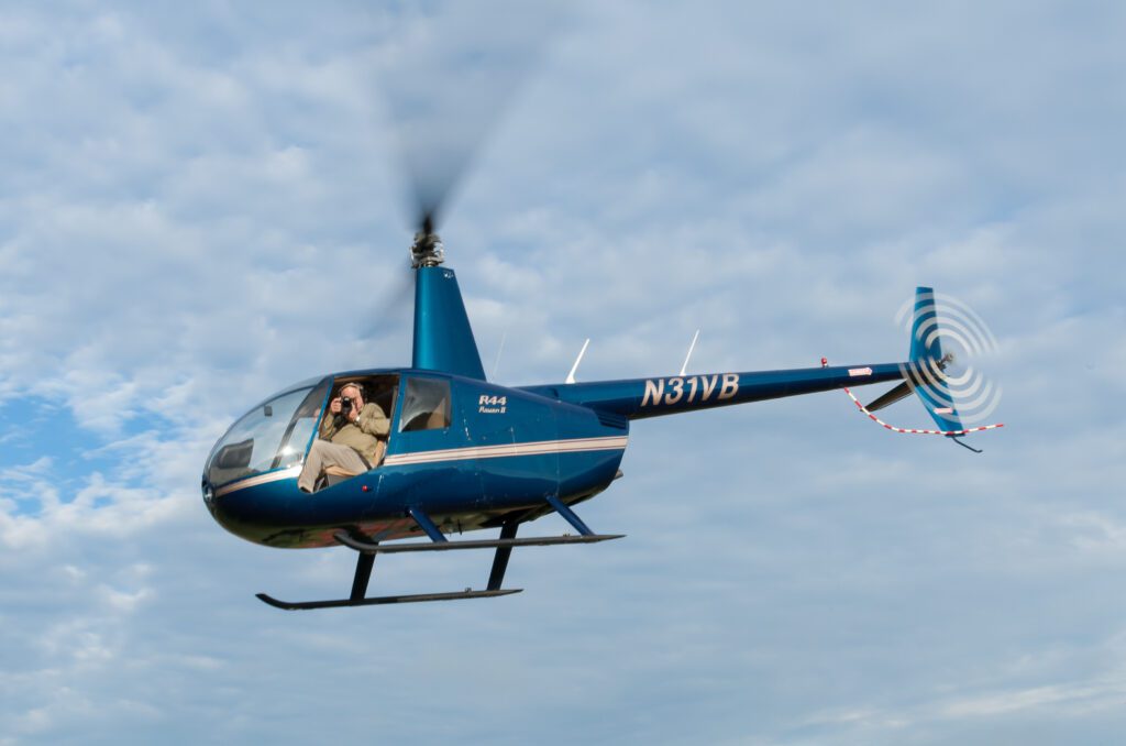
I have been doing aerial photography my entire career. I would hire a helicopter and remove the doors on the side I was shooting from. Here I am doing that on a photo shoot for a school.
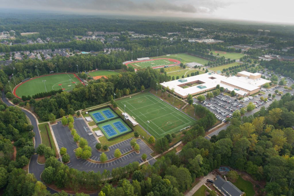
Now shooting from a Helicopter, you must be +500 feet above the ground. With a Drone, you are -400 feet above the ground.
So there are still times you may need a helicopter.
I can put a few helicopter shots on the website and explain that if we need to go higher than FAA rules for a drone, I can also offer that service.
What to include in your portfolio?
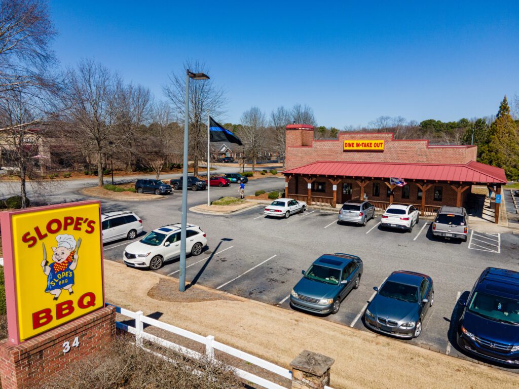
It would be best if you targeted a niche. I am going to try and pursue the commercial work and also have a few residential images on the website as well.
The commercial should pay a little better than the residential.
Now a couple of tips I have been picking up from other drone operators through their posts on the topic has been that what sells isn’t always what you see a lot on drone pilots’ pages.
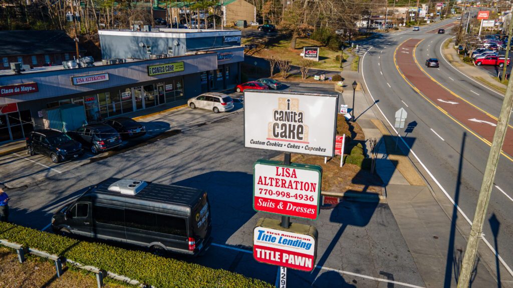
One guy realized over time that businesses often would buy stock drone footage of things around their business. For example, the Chamber of Commerce is more interested in shots that show off their town and not just pretty pictures of trees from the top.
From my research, I am working on a few things to shoot to build the website.
- Skyline of city
- Attractions
- Series of video clips that tell a short story of a place
- Short video to show a small town highlights on why to live there
- Short video to show a commercial property
Not So Easy
Flying a drone is making a photo shoot more complex than anything else I have done.
While this video looks OK, earlier that day, I shot another Hyperlapse. Watch what happens with the building.
So the learning curve on knowing what to do with the technology and the limits takes time to learn.
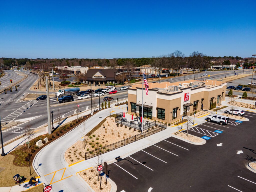
You must abide by two legal rules when flying a drone. You cannot pass over moving vehicles and people. There are exceptions, but for the most part, this impacts where you can fly.
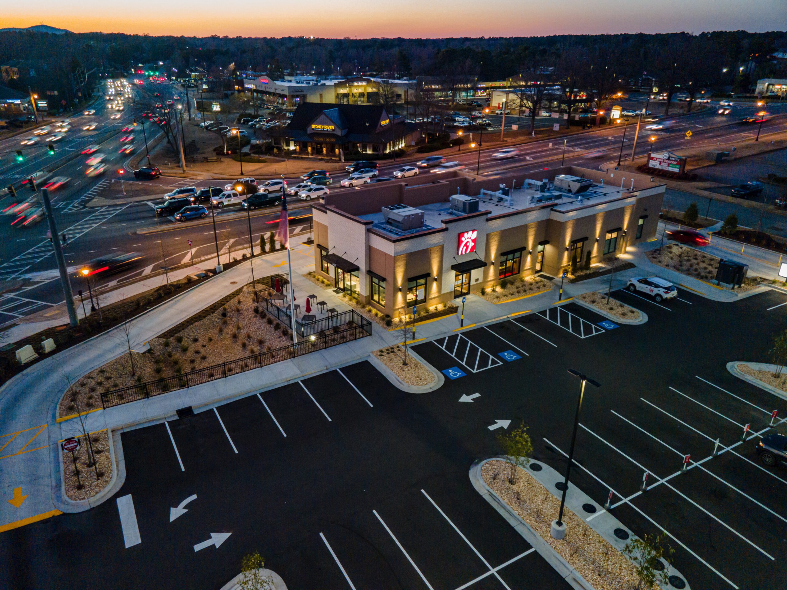
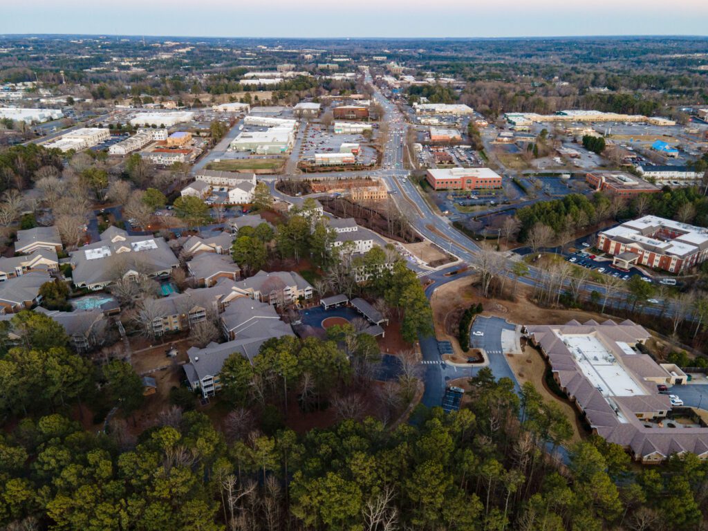
So for this shot of the Chick-fil-A, I am over a parking lot with no moving vehicles. No vehicles.
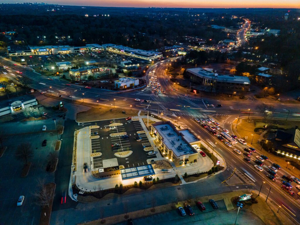
You can see the parking lot on the left of the frame where I flew to get photo 2 above. I am flying over another parking lot to get this photo.
Weather
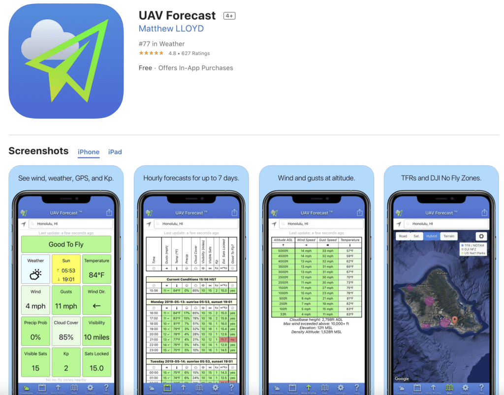
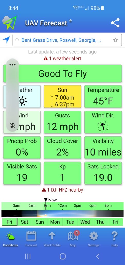
Each one of these variables in the App UAV Forecast can ground you. While you will see many flies regardless of the guidelines to be safe and not risk your or your client’s reputation, you want to play by the rules.
- 30 minutes after sunset until 30 minutes before sunrise, you cannot fly at night without a waiver. This rule is changing, but flying at night requires more knowledge of airspace at night. That training is not yet available but will be this month.
- My drone, the DJI Mavic Air 2, is not recommended to work below 32º Fahrenheit. The cold temperature can make the battery fail, crashing your drone when it stops flying.
- When I was in Civil Air Patrol, I learned that we couldn’t fly above 20-mile-per-hour winds with the planes we were using. My drone is recommended not to fly above 20 mph winds. So if the app shows even gusts above 20 mph, it will recommend not flying.
- Drones are not designed to fly in rain, snow, or sleet. The reason is the water can get into the motors or battery and cause a short. Again this will cause you to crash.
- Cloud cover needs to be a minimum of 500 feet above you to fly. If the cloud cover is 600 feet, you can only fly up to 100 feet. You also have to be 2000 feet away from clouds horizontally around you.
- You cannot fly a drone unless you have 3 miles of visibility.
- many things impact the satellites that your drone can see. While you can fly with no satellites, the ability of the drone to hover by itself and to get home require good satellite coverage. The recommendation of 10 or more satellites seems to give you the best flying condition.
- The Kp index measures geomagnetic disruption caused by solar activity on a scale from 0 (calm) to 9 (major storm). The higher the Kp index, the more likely you will have problems. Kp’s of 1-4 are entirely safe. Losing a satellite can mean a fly-away drone.
AirMap
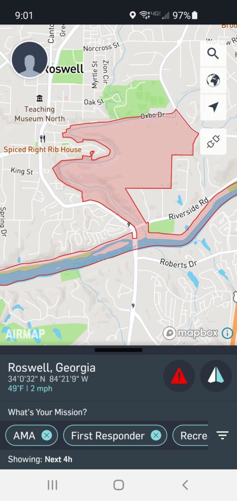
Another App worthy of mentioning is AirMap. It has many more things it can do for you. Including
- Request digital authorization for commercial operations in LAANC-enabled U.S. controlled airspaces
- Can I fly here? Get real-time feedback on airspace rules and conditions regarding your flight specifications, with national rulesets for 20 countries, including Canada, Germany, Japan, New Zealand, the United Kingdom, and the United States.
- Connect to any supported DJI drone to fly and toggle camera settings directly from the AirMap app
- Plan a flight path to a specific duration, altitude, and airspace requirements
When you plan your flight with the app, you can connect to DroneInsurance.com to buy insurance. When starting, Instant aviation liability coverage is more affordable than an annual policy. You can also increase your liability from 1 million, 2 million, 5 million, or higher.
Since drones crash, when the electronics fail to have your drone crash and do property damage isn’t what your clients want. Most will require you to show liability insurance to operate on their property.
There are many apps out there, and B4UFLY has a lot of positive reviews and has been updated recently.
As you can see, the time of day you make your drone shot dramatically affects the outcome. While some dawn and dusk shots are dramatic, many times, the daytime shot is more appropriate for a business that wants their customers to recognize their property during their business hours.
As you can see, a learning curve is affected by so many variables.
I hope that each day I can fly for the next month, I come away with one portfolio piece. To have enough variety is going to take some time.
One thing I didn’t even mention is the time of year. While you can fly throughout the year, the vegetation looks different each season. Not many people are excited to get drone photos during the winter, except for those winter vacation spots.
If you know of great locations near me in Georgia to explore, let me know.